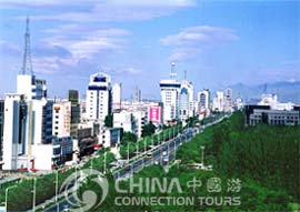
 The total area of Baotou covers 27,691 square kilometers, 160.6 square kilometers of which is urbanized It is the largest industrial city in Inner Mongolia Autonomous Region, and it lies in the "Golden Triangle" of the Hetao Plain. Baotou is rich in mineral resources. It is the iron and steel base for China, and the coal deposits make up about a quarter of China's reserve. It's an important industrial base for metallurgy, machinery manufacturing, rare earth, chemicals, non-ferrous metals, textiles, electronics and energy. The area is conveniently connected by rail with Beijing, Lanzhou, the Republic of Mongolia, and Russia.
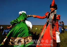
 Thirty-seven different nationalities live in Baotou. Mongols, Han, Man, Hui, Dawuer and Ewenke can be found here. The population is 2,011,000, and 1,300,000 of them are city dwellers.
Developed as a small commercial center in the 1880s, Baotou began to grow as a manufacturing hub while it was part of the Japanese-controlled state of Meng-chiang (1937-1945). It was returned to Chinese control in 1945 and became a center of heavy industry in the 1950s. The city was established in the Qing Dynasty (1644-1911 AD) on a Neolithic site, and is located just to the north of the Yellow River and the Gobi Desert. The city became the largest in the province after the Communists came to power in 1950.

